Traditional Stewardship of Water Resources
Traditional Water Management practices in the Central Highlands of Andros
Actions to Document, Preserve, Interpret & showcase
Andros the watery island
Andros Island is the northernmost of the Cyclades islands cluster in the Aegean Archipelago in Greece. One of the ancient names of Andros is Ydrousa, meaning the watery island. The abundance of water distinguishes Andros from the other dry Cycladic islands. Its mountainous character, its proximity to mountainous Evia, and the cold currents of the Cave D’ Oro (international water passage), between the two places, which attract moisture and clouds, partly explain the increased rainfall rates that Andros enjoys. The predominance of schist rock favors the infiltration of surface water and the enrichment of underground aquifers.
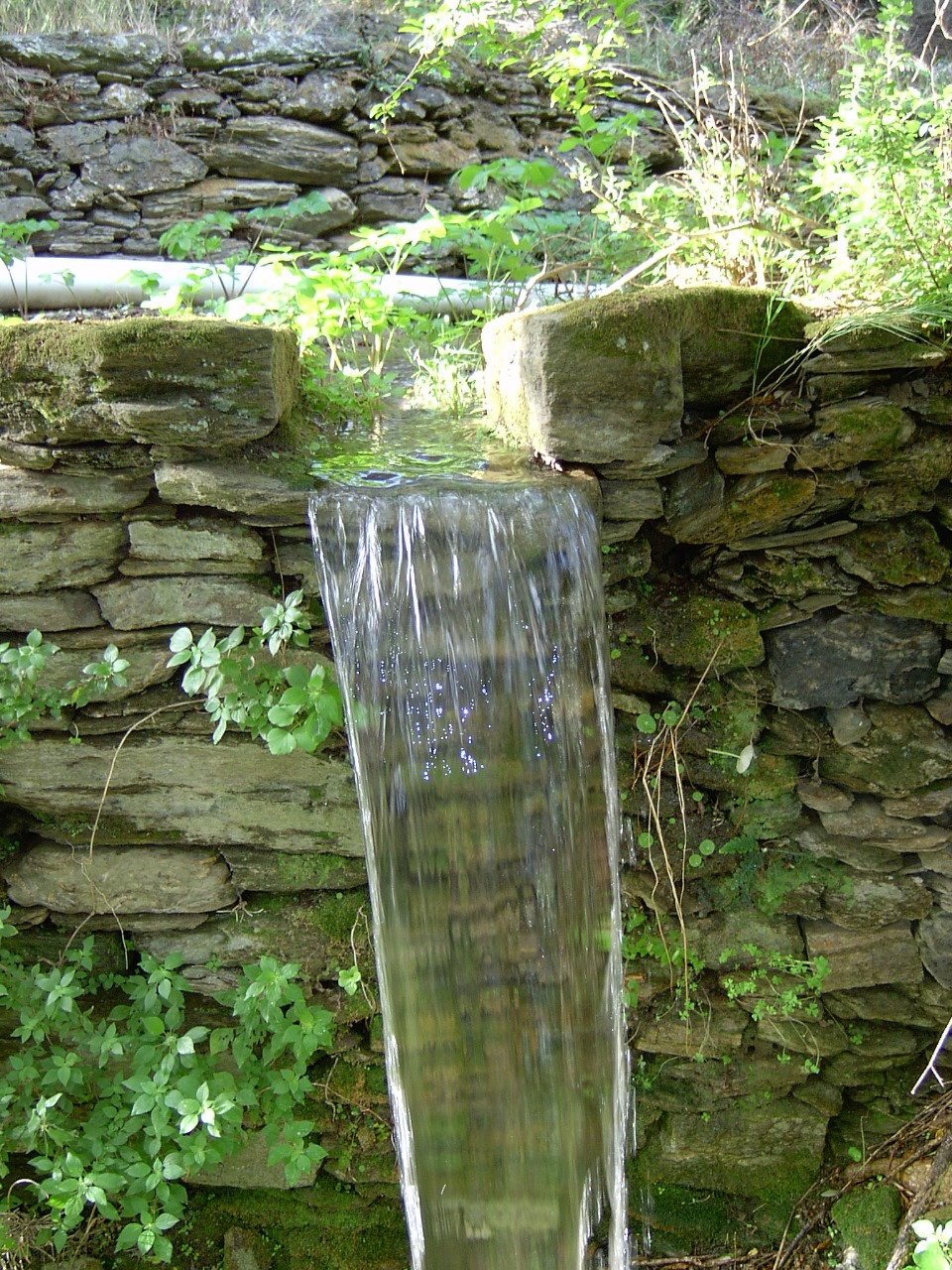
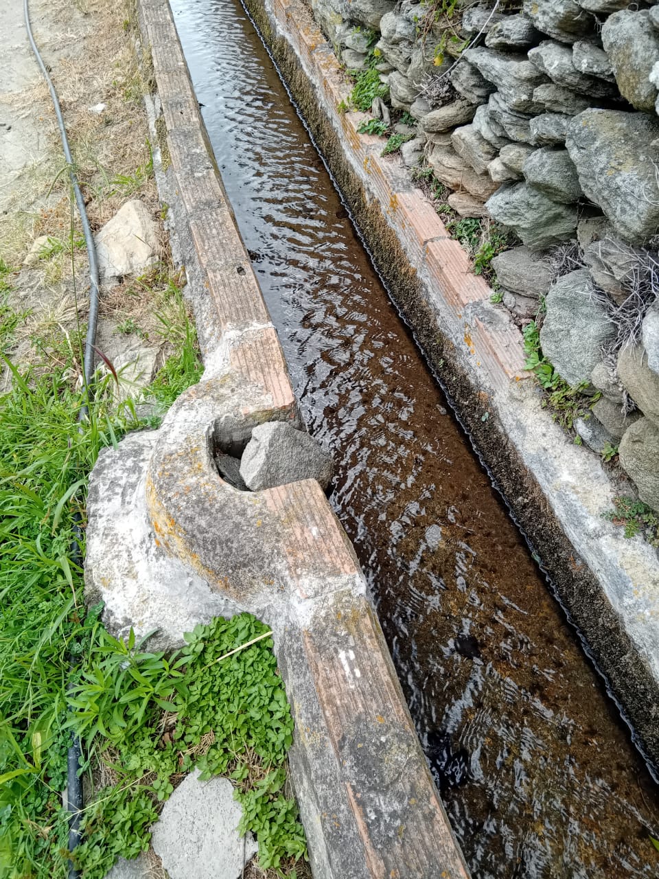
The importance and utilization of water are demonstrated by the numerous structures in the Andros agricultural landscape: dry stone wall terraces for the retention of soil and water, a network of water channels that from the mountain springs and gullies, channel the water to the small plains of the island for irrigation, the hundreds of stone water tanks that store water until it is consumed, the abundance of arched bridges and watermills. Andros developed an agricultural civilization based largely on the grace of water. Water favored the creation of microclimates in which important ecosystems developed, with a wide variety of flora and important fauna. It is no coincidence that today almost half of the island is classified as a Nature reserve, testifying to a rich biodiversity.
Traditional surface water management
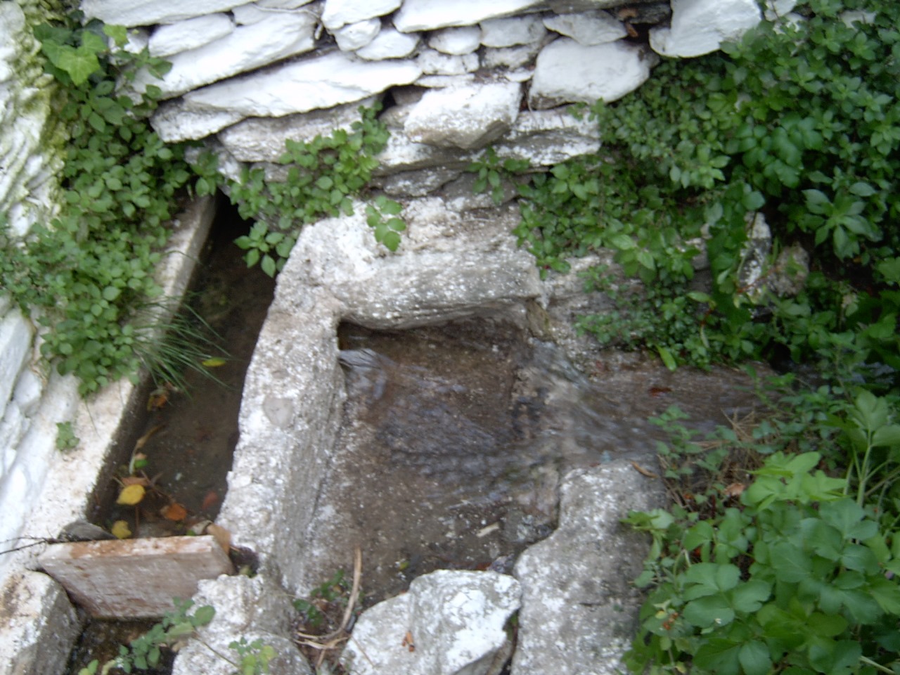
The management of surface water in Andros is a traditional ritual process, a customary practice, which seems to be passed down from generation to generation, linked to ownership. To implement water rights delimitation, before the use of clocks, the movements of the stars were used (from sunrise to sunset) or the use of marks in the landscape (until the sun meets a certain rock on a slope, for example) They are found on property titles and their delimitation is initially shaped by the movements of the stars (from sunrise to sunset) or the use of marks in the landscape (until the sun meets a certain rock on a slope, for example). The historian Dimitrios Polemis refers in an article to the so-called ‘nerochartia’ (water documents), which recorded agreements on the distribution of water between farmers, citing documents from the 17th and 18th centuries. These water rights seem to have been exercised for centuries, through the use and maintenance of surface water management systems consisting of central mountain springs, water tanks in networks, water cisterns for temporary storage, and the maintenance of which is done with knowledge and techniques that are passed on orally and empirically.
It is these practices, knowledge, locations, and elements of surface water management systems on the central mountain range of Andros, which is the richest location in water, that our action aims at recording, understanding, and preserving. These are both practices and sites that are in danger of being lost to oblivion, as along with the decline in agricultural activity over the last 10 years, water managers are becoming fewer and fewer, endangering knowledge and practices.
Action objectives
The objectives of our water project, are:
- the digital recording of the central mountain springs (mother springs) (locations, status, and water flow), on the central mountain range, and of constructions accompanying them (channels, stone tanks), using as reference an old non digital record of the mountainous springs of the Greek Military Service (digital map)
- the digital recording of all the public springs (locations, condition, water flow, and accompanying constructions) (cisterns, washing basins) situated within and above the 13 villages surrounding the central mountain range (digital map)
- the study and historical documentation, using written sources and oral history interviews, of the traditional surface water management practice of Andros (historical survey)
- awareness and admiration raising on the importance of the traditional surface water management practice of Andros and cultivating public support for the carriers of this practice, by applying the inscription of this traditional practice on the National Greek Inventory of Intangible Heritage
- designing the content for a digital guided tour on the importance of water and its management for Andros’ landscape, biodiversity, food security and the mitigation of fires, erosion and climate change
Beneficaries
The project sets the necessary knowledge basis on existing surface water management for next steps to ensure the sustainability of local water resources. Water resources are crucial for daily living, local agriculture, landscape preservation, fire, erosion and desertification prevention and mitigation and adaptation to climate change. Permanent, seasonal residents (9.000+40.000) and visitors are all beneficiaries of improved water management.
Local, regional, national, and international policymakers in natural resources management and sustainable planning can utilize the project’s findings and methodologies to develop better policies and practices across various fields, as water management is integral to numerous human activities.
An indeterminate number of scientists and researchers worldwide will benefit from the documented traditional water management practices of Andros, particularly those working in agricultural areas with similar water challenges.
Communities around the world, especially those in agricultural regions with similar water management systems, can draw inspiration and practical insights from the project’s success, fostering global knowledge sharing and environmental resilience.
Project short summary progress report
The project is reaching its completion at the end of July 2024. It has been a great and very insightful experience. The amount of water points and relative constructions recorded has exceeded our initial estimations. It has been a very demanding action, needing more resources. Dense vegetation and desertion of the old water ways has made it very difficult to trace the mountainous springs and their accompanying constructions (water channels, tanks, water cultivation points). Until today (15/07/2024):
- The historical and legal framework surveys have been completed.
- The record of springs within the 13 villages surrounding has been completed, resulting to 79 records of springs and 53 springs indicated but not checked on the field.
Currently, our field researcher, a local civil engineer who has a long experience walking on Andros’ mountains, is completing a recording of the features of the mountainous springs and their accompanying constructions and relative access options, on the central mountain range of Andros, creating individual maps for every one of the 13 surface water systems located on the central mountain range of Andros.
- At the link here https://www.google.com/maps/d/edit?mid=10FmJWGZlAt8CTcIHatXzJ0ylhLBWM54&usp=sharing you can have a look at the 13 mountainous water systems and their names. More detailed maps will be produced at the completion of the action
- At the link here https://www.google.com/maps/d/edit?mid=15HomMzcAy2S2PiQjHXQW4Sv2i5WvQRU&usp=sharing you can see the details of the Evrousses system. By clicking on elements of the map you can also use links to check the photos of each point. This is still a working map, a sample of the work that took place and is under progress.
- At the link here https://www.google.com/maps/d/edit?mid=1ZzibWINRXg6fCpmVRh_WkOImX58LWRM&usp=sharing you can see all the springs recorded within and in close proximity to the 13 villages surrounding the central mountain range of Andros, which is the study area. The majority of them (79 springs) have been recorded on the field with the help of local informants. 53 springs have been indicated remotely, as access to them was not easy. Hopefully we will have the chance to continue the survey and be able to confirm the existence and conditions of all the non recorded on the field ones.
Hopefully more resources can be invested to continue this exciting and of crucial importance first action. We envision enriching these records and piloting a project to clear the water ways in some regions, with wide promotion, in order to serve multiple purposes and uses.

The action “Traditional water management practices in the central mountainous area of Andros: Recording, preservation, interpretation and promotion actions” is supported by the Cycladic Identity initiative of the Museum of Cycladic Art. The Cycladic Identity initiative aims to actively contribute to the protection of the cultural and natural heritage of the cycladic islands, where the Cycladic culture was born and where it evolved, and to positively affect the local communities in their everyday lives.